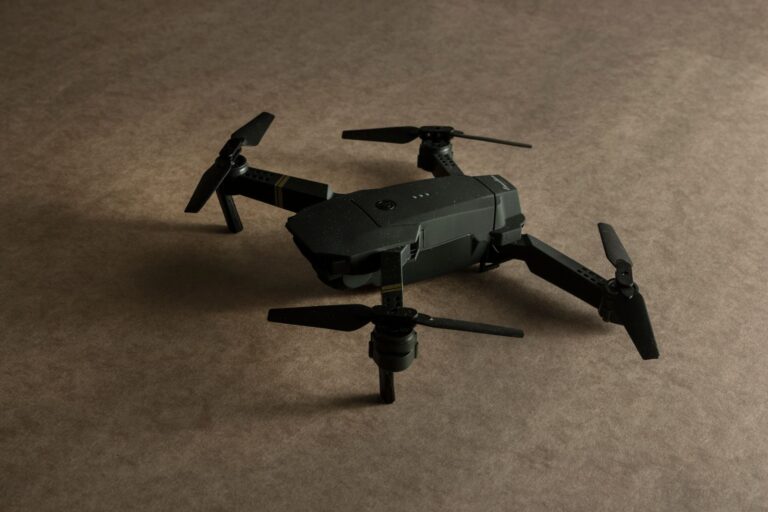

Tahoe National Forest is leveraging unmanned aerial vehicles to enhance wildfire prevention and response capabilities across its 871,000 acres in the northern Sierra Nevada. The deployment represents a growing trend in forest management where automation technology replaces or augments traditional ground-based patrol methods, allowing rangers to cover larger areas more efficiently while monitoring for fire violations and hazardous conditions in real-time.
Drone patrols offer several operational advantages over conventional surveillance: they can access remote terrain without creating new access roads, capture high-resolution imagery for violation documentation, and operate during periods when ground crews cannot safely patrol. In parallel, the forest has strengthened fire restrictions—periodic rules limiting activities like campfires, smoking, and equipment use—creating a two-pronged approach where technology enforces compliance while regulations prevent ignition sources. The initiative addresses a practical challenge facing national forests: vast land areas with limited personnel budgets, combined with increasingly severe fire seasons that demand faster detection and response capabilities.
Table of Contents
- How Drone Patrols Enhance Forest Surveillance and Fire Detection
- Fire Restrictions and Enforcement Challenges in Large Forests
- Technology Integration with Traditional Forest Management
- Operational Deployment and Personnel Requirements
- Weather, Smoke, and Limitations on Continuous Monitoring
- Data Management and Real-Time Decision Support
- Integration with Fire Restriction Signage and Public Awareness
How Drone Patrols Enhance Forest Surveillance and Fire Detection
Unmanned aerial systems deployed for forest monitoring typically carry electro-optical and thermal imaging payloads, enabling operators to spot visible fire, smoldering materials, and unauthorized activities simultaneously. A thermal camera can detect heat signatures invisible to ground observers, particularly useful for identifying small fires in their earliest stages before they spread across tinder-dry vegetation. This capability compresses the detection-to-response timeline, which is critical in environments where a fire can double in size within hours. Drones can also patrol areas that terrain or access restrictions make difficult for foot patrols. Fire lookout towers, traditional detection infrastructure, cover single vantage points; a drone flying a systematic grid pattern over ridges and valleys provides continuous monitoring coverage.
Operators can review flight logs and footage weeks later, documenting unauthorized activities or hazardous conditions in ways that support law enforcement action. However, a significant limitation is weather dependency: high winds, heavy smoke, and low visibility can ground operations during exactly the fire conditions when monitoring is most critical. Range and endurance present another tradeoff. Most commercial drone platforms operate for 20 to 45 minutes per battery charge and have transmission ranges of 5 to 10 kilometers from the operator. Covering 871,000 acres requires either multiple drones working in coordinated patterns or rotating patrol schedules that leave gaps in surveillance. Personnel training, maintenance, spare parts, and regulatory compliance add recurring operational costs that must be budgeted alongside the aircraft themselves.
Fire Restrictions and Enforcement Challenges in Large Forests
Fire restrictions are temporary or seasonal prohibitions that reduce ignition sources on forest land. Common restrictions include bans on open campfires (except in constructed fire rings at designated sites), smoking restrictions outside vehicles or developed areas, and limitations on heavy equipment operation during peak fire danger periods. Enforcement relies on ranger patrols, visitor education, and incident reporting by other forest users. Without drones or aerial surveillance, enforcement is labor-intensive and reactive. A ranger patrolling a single valley on foot can respond only to reports or visible violations within their patrol area.
Documenting violations—photographing an unattended campfire, recording an individual burning debris outside designated zones—requires physical presence, which limits response speed and may deter enforcement in remote areas. Drones allow rangers to respond to tips or suspicious activity observed from the air, increasing the likelihood that violators encounter enforcement pressure. The enforcement limitation is that video or aerial imagery alone often does not result in citations without ground follow-up. A drone operator may observe a campfire at a specific GPS coordinate, but if the individuals responsible depart before ground personnel arrive, enforcement becomes difficult. Additionally, some restrictions are time-limited (for example, a ban on certain activities only during afternoon hours when fire danger peaks), making real-time detection and rapid response systems essential for effective compliance.
Technology Integration with Traditional Forest Management
Tahoe National Forest manages prescribed burns, defensible space projects, and fuel reduction to mitigate wildfire risk. Drones support these projects by mapping fuel density, documenting vegetation conditions before and after treatment, and monitoring burn boundaries during prescribed fire operations. A drone equipped with a multispectral camera can assess vegetation health and identify areas where fuel accumulation poses the highest risk—information that informs where to prioritize mechanical thinning or other mitigation work. Integration also means that drone data flows into broader forest management systems.
Imagery and video feeds are reviewed alongside weather data, fire activity reports, and visitor use patterns to create a multi-source understanding of conditions. For example, if a drone detects a campfire in an area where fire danger is forecast to be extreme, and fire restriction signs indicate campfires are prohibited, rangers can prioritize response to that location over other areas. This prioritization reduces response time and concentrates limited enforcement resources where violation risk is highest. A specific example: after a fire detection event, drone footage can be rapidly reviewed to determine fire size, direction of spread, and accessibility for ground crews, allowing incident commanders to deploy resources more accurately than if they relied on ground sightings or radio reports alone. Conversely, drones cannot replace all field reconnaissance—terrain, structures, and hazards on the ground require physical inspection before equipment is committed to a suppression or prevention effort.
Operational Deployment and Personnel Requirements
Deploying drones operationally requires operators licensed under FAA Part 107 regulations, which mandate knowledge of airspace rules, aircraft systems, emergency procedures, and safety protocols. Tahoe National Forest personnel responsible for drone operations must hold this certification, which requires training and examination. Beyond the operator, missions typically require a visual observer—a dedicated individual who monitors the airspace and alerts the operator to hazards—and a safety briefing before each flight. This personnel requirement creates a scheduling constraint. Unlike a ranger who can combine drone operations with other duties, a dedicated drone mission ties up at least two personnel for the duration.
A typical patrol flight covering a high-risk area might consume four to six hours of total staff time (planning, pre-flight checks, flight time, data review, and reporting), which can be justified when fire danger is extreme but becomes harder to sustain as a routine activity. Many forest services address this by concentrating drone operations during peak fire season rather than year-round. Training and certification maintenance also incur costs. Operators must recertify knowledge and skills periodically, and staying current on aircraft updates, regulatory changes, and evolving best practices requires ongoing professional development. Smaller forests or regions with limited budgets may struggle to justify these costs if drone deployment remains a specialized capability rather than routine infrastructure.
Weather, Smoke, and Limitations on Continuous Monitoring
Forests experience seasonal and daily variations in weather that constrain drone operations. High winds (above 25 mph for most commercial platforms) force cancellations, which is problematic because wind often correlates with high fire danger—the exact conditions when monitoring is most needed. Smoke from active fires or prescribed burns obscures optical sensors and can disorient operators flying visually. Thermal imaging penetrates light smoke but loses effectiveness in dense plumes. Altitude restrictions also create blind spots.
Drones operating at legal altitudes (typically 400 feet above ground level in remote areas, with exceptions for specific operations) cannot see into ravines or behind ridge lines without repositioning. Snow accumulation or icing on the aircraft can disable sensors or force landings. Night operations, where wildfire detection is particularly valuable, require specialized infrared equipment and night-vision capability, which increases cost and adds complexity. A critical warning: relying solely on drone surveillance to prevent wildfires understates the importance of fuel management, public education, and landscape-scale prevention. Drones detect violations and fires, but they do not reduce the fuel available to burn or address the underlying conditions that allow small fires to become catastrophic. Forest management agencies using drones should view them as one tool within a comprehensive fire prevention strategy that includes prescribed burning, thinning, restoration, and community engagement.
Data Management and Real-Time Decision Support
Drone flights generate large volumes of data—high-resolution video, thermal imagery, GPS coordinates, flight telemetry, and metadata. Managing this data requires infrastructure for storage, processing, and analysis. Agencies must decide whether to review footage in real-time (demanding immediate personnel attention) or archive and analyze after flight completion.
Real-time analysis enables faster response to detected violations or fires but increases operational complexity and personnel demand. Some agencies integrate drone data into GIS (geographic information system) platforms, where imagery is georeferenced and layered with maps of restricted zones, campgrounds, recent fire scars, and other contextual information. This integration allows for pattern analysis—for example, identifying whether violations cluster in particular areas or times—that can inform enforcement strategy. Data retention and security also pose challenges; video evidence of violations may need to be preserved for legal proceedings, requiring compliant storage systems.
Integration with Fire Restriction Signage and Public Awareness
Fire restrictions are effective only when the public understands them. Tahoe National Forest posts signage at trailheads, campgrounds, and access points indicating which restrictions are in effect (fire ban levels, campfire status, equipment restrictions). Drones cannot replace this outreach; rather, they increase the likelihood that violations will be detected and create a deterrent effect when violators understand that aerial monitoring is in place.
Some agencies announce drone operations or post signage stating that drone surveillance is active, which can improve compliance through awareness alone. Whether this announcement proves more or less effective than silent enforcement remains an empirical question. The integration approach assumes that visible enforcement presence, combined with clear communication of restrictions, encourages voluntary compliance better than either tool alone.
- —