ARBE Robotics has positioned itself as a dominant force in high-resolution 3D sensing technology, earning comparisons to Google’s dominance in search by establishing industry-leading standards for perception in autonomous vehicles and robotics. The Israeli company has developed 4D imaging radar technology that delivers what competitors struggle to match—simultaneous high resolution and extended range without the weight, power consumption, or cost penalties of LiDAR alternatives. Rather than competing directly with LiDAR on traditional metrics, ARBE created an entirely different performance class: a sensor that excels in adverse weather, dense urban environments, and applications where LiDAR would require massive computational overhead or fail outright.
The “Google of sensors” comparison reflects ARBE’s market strategy and technical moat, not just their market size. Like Google’s search dominance came from solving a problem better than anyone else, ARBE’s competitive advantage stems from superior signal processing algorithms that extract far more information from radar returns than the industry thought possible. Their 4D radar produces perception data with resolution comparable to LiDAR while maintaining radar’s inherent advantages: performance in rain, snow, fog, and direct sunlight that blind optical sensors. For roboticists and automation engineers, this represents a fundamental shift in how they approach sensor fusion and environmental understanding.
Table of Contents
- What Makes ARBE’s 4D Radar Technology Different From Traditional Sensors?
- Technical Capabilities and the Processing Complexity Challenge
- Real-World Applications in Autonomous Vehicles and Robotics
- Market Positioning Against LiDAR and Optical Alternatives
- Integration Challenges and Sensor Fusion Considerations
- Industry Adoption and Emerging Use Cases
- Future Outlook and Technological Evolution
- Conclusion
What Makes ARBE’s 4D Radar Technology Different From Traditional Sensors?
arbe‘s core innovation lies in software-driven signal processing that transforms commodity radar hardware into a perception engine. Traditional automotive radar delivers detection in a few categories—vehicles, pedestrians, obstacles—with limited resolution. ARBE’s technology generates dense point clouds with hundreds of thousands of detection points per frame, spatial resolution measured in centimeters, and velocity information at each point. This density fundamentally changes what’s possible: instead of knowing a car is 50 meters ahead, an ARBE-equipped system knows the precise contours of that car, distinguishes between a motorcycle and a truck, and identifies obstacles smaller than traditional radar ever could detect. The technical comparison is instructive.
A conventional automotive radar might achieve 0.5-meter range resolution and 5-degree angular resolution. ARBE’s 4D radar achieves centimeter-level range resolution and sub-degree angular precision. The difference matters enormously in congested urban environments where a dumpster, pothole, or cyclist emerges suddenly. The company accomplishes this by rethinking the entire signal chain—from antenna array design through beamforming, Doppler processing, and AI-powered clustering algorithms. Their approach doesn’t require the massive computational loads that would make traditional radar processing equivalent to LiDAR—they extract the resolution through smarter algorithms, not brute force.

Technical Capabilities and the Processing Complexity Challenge
ARBE’s 4D imaging capability means each sensor returns range, azimuth, elevation, and velocity information simultaneously—four dimensions of environmental data in every frame. The sensor operates at 20 Hz or higher, producing millions of points per second that must be processed in real-time. This is where many implementers encounter their first limitation: the computational pipeline required to ingest and interpret ARBE data isn’t trivial. While ARBE’s algorithms are optimized for efficiency compared to LiDAR point cloud processing, the integration still demands capable hardware and careful software architecture. Weather resistance is ARBE’s signature strength, but it comes with a tradeoff worth understanding.
Because the system uses millimeter-wave radar, it penetrates through atmospheric obscuration that stops optical and LiDAR sensors cold. Heavy rain that renders LiDAR nearly useless degrades ARBE’s performance marginally, and snow doesn’t blind it at all. However, certain radar-reflective surfaces—like metal overhead structures, large calibrated reflectors, or dense metallic grids—can create artifacts or false detections that require careful filtering. The company’s algorithms handle this better than traditional radar, but implementers in industrial environments with extensive metal infrastructure need to test thoroughly. Additionally, while ARBE’s hardware footprint is smaller than LiDAR systems, the installation orientation matters more; radar performance depends on proper antenna alignment and mounting location.
Real-World Applications in Autonomous Vehicles and Robotics
ARBE’s customer base spans autonomous vehicle manufacturers, industrial robots, and mobile robotics companies. In autonomous trucking, the technology enables reliable obstacle detection during night driving or whiteout winter conditions—scenarios where optical and LiDAR-based solutions require driver intervention or conservative speed reduction. A customer deploying autonomous shuttle services in northern climates discovered that ARBE sensors maintained consistent detection rates through snow that forced their backup LiDAR system to minimum-confidence states, eliminating the latency of decision logic switching between redundant sensor chains.
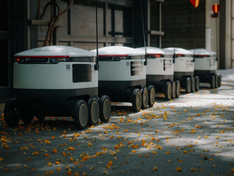
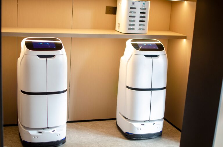
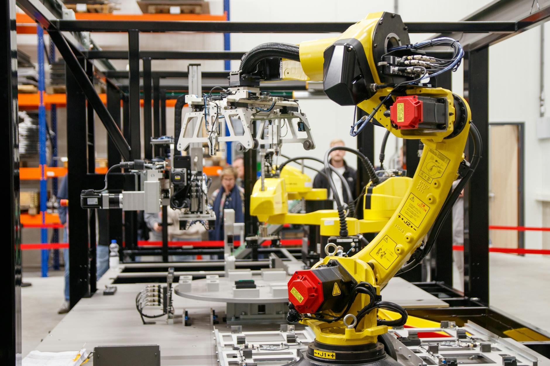
In warehouse automation, ARBE sensors power autonomous mobile robots that must navigate cluttered environments where cost-per-unit matters. A logistics company deployed 50 mobile robots equipped with ARBE’s sensors in their fulfillment center, discovering that the sensors’ ability to detect small obstacles (cardboard corner-cuts on the floor, scattered packing peanuts) without requiring the $20,000-per-unit LiDAR investment changed the economics of the entire deployment. The company could outfit each robot with ARBE’s $3,000-5,000 sensor package and still see three-year ROI, versus impossible capital requirements with traditional high-resolution alternatives. Colloborative robots working in human environments similarly benefit from ARBE’s pedestrian detection capability and weather independence for facilities with loading docks or outdoor work areas.
Market Positioning Against LiDAR and Optical Alternatives
ARBE operates in a three-way competitive field: LiDAR (high resolution, poor weather, expensive), camera-based vision (excellent in good light, fails in adverse weather), and traditional radar (weather-proof, low resolution). Rather than claim superiority across all dimensions, ARBE positions itself as the best solution for the specific problems LiDAR doesn’t handle well. The company’s competitive narrative focuses on total cost of ownership, not just sensor cost. A customer comparing LiDAR versus ARBE for autonomous delivery in varied weather discovers that the cheaper ARBE hardware costs less upfront, reduces the computational overhead in the vehicle’s main computer (freeing resources for other tasks), and eliminates the operational complexity of LiDAR’s sensitivity to dust, rain, and laser reflections from unexpected surfaces.
The tradeoff is clear: ARBE trades some of the highest possible spatial resolution for more robust performance across environmental conditions. Where LiDAR achieves sub-centimeter accuracy in ideal conditions, ARBE guarantees centimeter-level accuracy in nearly all conditions. For applications where operation in rain or nighttime scenarios is mandatory, ARBE’s approach wins decisively. For applications where the vehicle operates only in controlled indoor or consistently clear conditions, and where the absolute highest resolution matters, LiDAR remains the better choice. The comparison requires understanding the specific operational context, not just reviewing specification sheets.
Integration Challenges and Sensor Fusion Considerations
Implementing ARBE’s sensors requires careful thought about sensor fusion architecture. The 4D data is fundamentally different from LiDAR point clouds or camera images—it’s processed radar returns with velocity information built in. Engineers accustomed to treating radar as a simple detection sensor and working primarily with LiDAR point clouds must rethink their perception pipeline. ARBE provides software libraries and reference implementations, but the integration isn’t automatic. Developers have reported that the initial phase of system integration typically requires 2-4 months to achieve production-quality performance, compared to 3-6 months for equivalent LiDAR-based systems.
This suggests the integration complexity is lower, but the learning curve is real. One specific warning: radar reflections off large metallic structures can create phantom detections or miss actual obstacles in the radar shadow of the structure. In industrial settings with overhead conveyors, metal warehouse racking systems, or vehicles passing under metal structures (bridge overpasses, awnings), developers must validate that their deployment environment doesn’t create systematic blind spots. ARBE’s algorithms filter many such artifacts, but they’re not eliminated entirely. The sensor performs best when positioned to view the environment with clear angular separation between the robot and structural obstacles. Additionally, the sensor’s velocity measurements can be misinterpreted if the mounting platform itself is vibrating—proper shock isolation and careful calibration are essential, not optional.
Industry Adoption and Emerging Use Cases
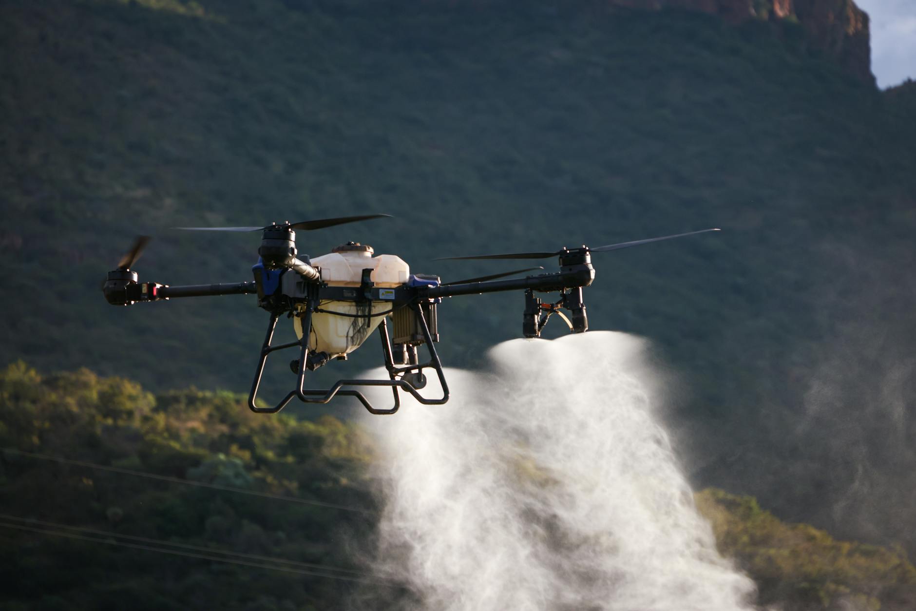
Several autonomous vehicle programs have committed to ARBE as their primary perception sensor or core component of a multi-sensor suite. Autonomous freight companies operating in challenging climates have become major customers, validating the weather-performance advantage in real deployments. Agricultural robotics represents an emerging application where ARBE’s technology shows particular promise—autonomous tractors and harvesters operate in dusty, variable-lighting conditions where optical sensors struggle, and the extended range of 4D radar (typically 100+ meters) enables the detection of obstacles far ahead on unpaved terrain.
Mining and construction equipment manufacturers are evaluating ARBE for autonomous haul trucks and dozers operating in open pit mines where dust clouds make LiDAR unreliable. A mining equipment company conducting field trials found that ARBE sensors maintained consistent object detection through dust clouds that incapacitated optical and LiDAR systems, while still delivering the spatial resolution necessary to maintain safe clearance from pit walls and other vehicles. This application class—perception in inherently dusty, weather-challenged environments—may prove to be ARBE’s most defensible market position, where the technology’s inherent advantages outweigh any remaining disadvantages.
Future Outlook and Technological Evolution
ARBE’s technology roadmap includes higher density point cloud output, improved velocity estimation for multiple objects, and expanded range capabilities. The company is actively developing specialized firmware variants for different application classes—autonomous vehicles, robotics, industrial automation—rather than offering a one-size-fits-all sensor. This application-specific customization approach is borrowed directly from how semiconductor and sensor companies achieve dominance (similar to how specialized processor designs beat general-purpose chips in specific domains).
If ARBE successfully executes on application-specific optimizations while maintaining compatibility across their product line, they’ll cement the “Google of sensors” positioning through platform effects. The competitive landscape will likely see both LiDAR manufacturers adopting some of ARBE’s algorithmic innovations and radar competitors improving their signal processing. However, ARBE’s first-mover advantage in 4D imaging radar, combined with their patent portfolio and software moat, suggests their competitive position will strengthen rather than erode over the next 3-5 years. The critical factor for continued dominance will be ecosystem development—enabling integrators, robotics companies, and autonomous vehicle manufacturers to efficiently incorporate ARBE’s sensors into their products without excessive custom engineering.
Conclusion
ARBE Robotics earned the comparison to Google of high-resolution sensors by solving a genuine problem better than existing alternatives: delivering high-resolution environmental perception in conditions where traditional LiDAR and optical sensors fail. Their 4D imaging radar technology represents genuine innovation in signal processing and sensor design, not incremental improvement. The technology’s advantages in adverse weather, lower cost, and reduced computational overhead make it genuinely compelling for specific application classes, particularly autonomous systems operating in challenging environmental conditions.
For roboticists and automation engineers evaluating perception systems, ARBE represents a genuine alternative to LiDAR-centric approaches, not a compromise sensor. The technology requires thoughtful integration, site-specific validation, and understanding of its limitations in certain environments. But for autonomous vehicles and robots operating reliably in rain, snow, and dusty conditions, ARBE’s sensors have become the default choice—exactly the position Google holds in web search.