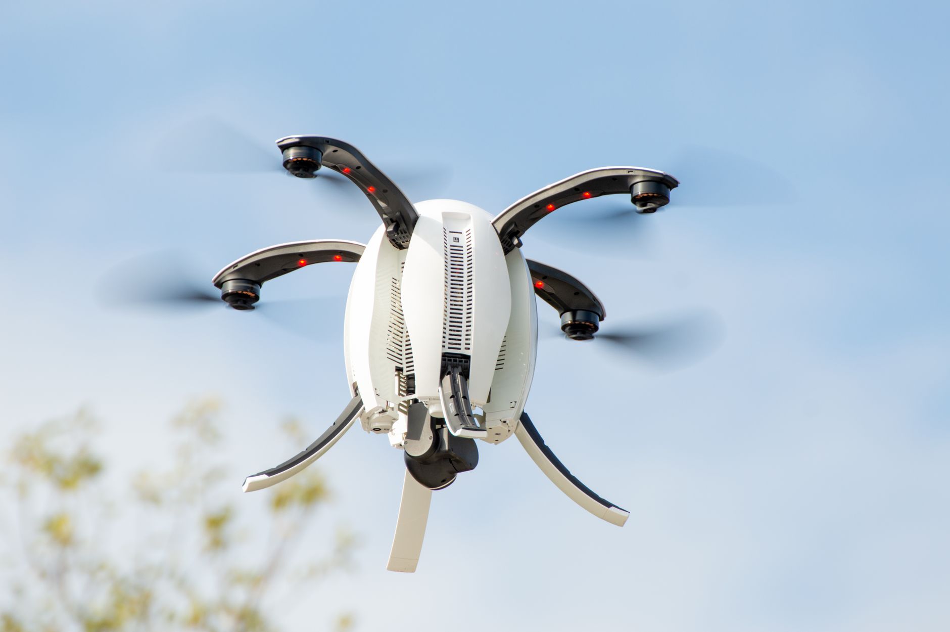

Police departments across North America are deploying unmanned aircraft for emergency response, search and rescue, and crime investigation—creating a genuine operational advantage in time-sensitive scenarios. Yet this technology expansion has triggered a parallel debate over surveillance scope, data retention, and citizen consent that no existing legal framework adequately addresses. The tension is not theoretical: a police drone can locate a missing child in minutes, but the same technology can also monitor protests, track individuals across neighborhoods, or collect footage without clear limits on storage or sharing. Cities are attempting to balance these competing interests through local drone policies that restrict when, where, and how law enforcement can deploy unmanned systems. Some departments operate under strict protocols requiring judicial approval for non-emergency flights.
Others maintain broad discretion during declared emergencies. A few jurisdictions have banned police drone use entirely, while many have no formal policy at all. The regulatory landscape remains fragmented—a patchwork of municipal ordinances, state laws, and federal aviation rules that sometimes contradict or leave critical questions unresolved. The fundamental problem is that police drones do not fit neatly into either search-warrant doctrine or reasonable-expectation-of-privacy law. A helicopter doing surveillance must stay above certain altitudes and is visible to observers; a drone is silent, operates at night with thermal imaging, and can hover over private property in ways that challenge traditional assumptions about what constitutes intrusion.
Table of Contents
- Why Police Departments Deploy Drones During Emergencies
- The Privacy and Surveillance Challenge
- How Different Cities Regulate Police Drones
- The Technical Reality of Police Drone Systems
- The Hazard of Emergency Creep and Vague Authorization Standards
- Facial Recognition and Data Integration
- The Path Forward—Defining Standards Without Paralyzing Response
- Frequently Asked Questions
Why Police Departments Deploy Drones During Emergencies
Unmanned aircraft provide rapid situational awareness that ground units cannot match. A missing elderly person, a barricaded suspect, a traffic collision, or a building fire can be assessed from the air in seconds rather than minutes. Search and rescue operations, where every minute affects survival odds, represent the strongest use case for police drone deployment. A department searching a wilderness area or urban structure after dark can use thermal imaging to detect human body heat—a capability that no ground team can replicate.
The operational argument is compelling: departments in jurisdictions with active drone programs report that these tools have accelerated response times and improved officer safety by reducing the need for dangerous ground-based reconnaissance. A drone can survey a dangerous scene, identify threats, and provide real-time information to arriving units without exposing officers to ambush or harm. In wildfire scenarios, law enforcement drones assist firefighters by mapping evacuation routes and identifying structures at risk. However, the ease of deployment creates institutional pressure to normalize drone use beyond emergencies. A tool that is valuable in genuine crises can gradually become routine for lesser purposes—follow-ups on noise complaints, monitoring parking lots, or general neighborhood surveillance during quiet periods. The distinction between emergency deployment and habitual monitoring depends entirely on departmental discipline and oversight mechanisms that many jurisdictions lack.
The Privacy and Surveillance Challenge
Thermal imaging, facial recognition, and persistent video recording raise distinct privacy concerns that many existing regulations do not address. When a drone equipped with thermal cameras can observe activity inside a home through walls and windows, the legal question of what constitutes an “unreasonable search” becomes difficult to answer using case law written for different technologies. Courts have not universally decided whether thermal imaging from a drone requires a warrant, though Supreme Court precedent on thermal imaging of homes suggests it should. A critical weakness in current policies is the absence of clear rules for data retention and sharing. A department might film private activities during an authorized emergency response, then retain that footage indefinitely, share it with federal agencies, or use it in contexts far removed from the original purpose.
Some jurisdictions have implemented automatic deletion policies—footage is erased after 30 or 60 days unless formally retained for evidence. Others store footage indefinitely. The lack of transparency means citizens often have no way to know whether a drone captured their home, their vehicle, or their movement pattern. Privacy advocates argue that the precedent set by police drone deployment affects other surveillance technologies. If drones become normal police tools without strong safeguards, the same logic can justify expanded use of license-plate readers, cell-site simulators, and other persistent surveillance systems. The cumulative effect across technologies is not visible in any single drone flight, but across years and cities, the ability of law enforcement to track and observe citizens intensifies.
How Different Cities Regulate Police Drones
San Francisco, Oakland, and Seattle implemented early policies that required specific authorization for drone deployment, limited use to certain scenarios, or imposed outright bans. San Francisco’s ordinance prohibits city departments from using facial recognition or drones without explicit approval from city supervisors, setting a high bar for adoption. This approach reflects the belief that new surveillance tools should require affirmative democratic authorization rather than default permission. Other cities, including Los Angeles and Houston, permit police drone use with internal departmental oversight but without external judicial review.
A watch commander can authorize a drone flight for investigation of a crime scene, and the department’s policies govern when and how footage can be retained. This approach is faster but relies on institutional integrity rather than external checks. A middle ground exists in jurisdictions requiring judicial approval for non-emergency drone flights but permitting rapid deployment during declared emergencies—active crimes, missing persons, or disaster response. The logic is that emergency scenarios have less time for warrant procedures, but non-emergency surveillance still receives judicial scrutiny. The weakness is defining what qualifies as an emergency and ensuring that exceptions do not expand to encompass routine investigations.
The Technical Reality of Police Drone Systems
Current police drones are not uniformly sophisticated. Many departments use commercial off-the-shelf systems from manufacturers like DJI, which are affordable but have limited range, flight time, and sensor capability. A typical police drone might fly for 20 to 30 minutes on a charge, operate within line of sight or with limited telemetry, and carry a standard visible-light camera or basic thermal sensor. These limitations mean police drone surveillance is episodic rather than persistent—the drone is deployed for a specific incident, not maintained aloft continuously. However, some federal agencies and larger police departments are moving toward more capable systems.
Persistent aerial surveillance (PAS) platforms, originally developed for military operations in Iraq and Afghanistan, can loiter over an area for hours and track all movement within a radius of several kilometers. A handful of police departments have tested or deployed these systems with minimal public disclosure. If PAS platforms become common in domestic law enforcement, the privacy implications are fundamentally different—the ability to rewind footage and track any observed person or vehicle retrospectively represents persistent monitoring rather than responsive investigation. The technical trajectory matters for policy. Regulations written for drone flights lasting 20 minutes may be inadequate if departments acquire systems capable of eight-hour surveillance operations. Most current local policies do not distinguish between different types of drones or sensor capabilities, creating a gap between what rules permit and what technology enables.
The Hazard of Emergency Creep and Vague Authorization Standards
History shows that emergency authorities, once granted, rarely return to narrow scope. Police departments authorized to use drones for missing persons or active shooters often find themselves using drones for vehicle pursuits, property crimes, and disorder monitoring—all justified as urgent circumstances. Without specific definitions of what constitutes an emergency, the exception can expand to encompass nearly any situation a department deems time-sensitive. A critical warning: some jurisdictions permit police drone deployment under vague standards like “good cause” or “in the officer’s judgment” without requiring documentation, supervisor approval, or any form of review.
This arrangement is accountability in name only. The officer initiating the drone flight faces no immediate consequence for questionable judgment, and review occurs only if someone challenges the specific action afterward. Absent systematic oversight, drift toward expanded use is nearly inevitable. The solution requires either strict lists of permitted uses—missing persons, active violent crimes, major disasters—or strong external oversight that requires pre-approval or rapid post-authorization review. Departments that have implemented automatic deletion policies and required documentation of drone deployments report no loss of operational capacity, suggesting that transparency and limitations do not inherently undermine emergency response.
Facial Recognition and Data Integration
Some police drone deployments include facial recognition software, creating additional privacy hazards beyond the drone itself. When aerial footage is scanned against mugshot databases, warrant lists, or other facial databases, the scope of surveillance becomes categorical: all people observed by the drone are checked against law enforcement records. This is categorically different from a police officer seeing a person and recognizing them. A facial recognition system deployed from a drone can identify hundreds of people in a single flight, many of whom are uninvolved in any crime or incident.
The accuracy of facial recognition varies widely by race and age, meaning misidentifications are concentrated among people of color and younger individuals. If a facial recognition system flags someone incorrectly, the person may find themselves contacted or detained based on a computer error, with the drone flight creating a record and the technology creating plausible legal cover. Few departments disclose whether their police drones include facial recognition or under what standards identified individuals are contacted or investigated. The absence of clear policy combined with the power of the technology represents a substantial risk.
The Path Forward—Defining Standards Without Paralyzing Response
Functional police drone policies share certain elements: a list of specific permitted uses, a requirement for departmental authorization and documentation, a data retention schedule that mandates deletion of non-evidentiary footage, and regular public reporting of drone deployments. Some include judicial approval for non-emergency flights, and an increasing number prohibit facial recognition or place conditions on its use. The most effective policies distinguish between emergency and non-emergency deployment, accepting that emergency scenarios may not permit time for judicial review while insisting that post-deployment documentation and review occur.
A missing person search authorizes drone flight without advance approval; a property crime investigation requires documented justification. This approach preserves operational capacity during genuine time-pressure scenarios while maintaining a check on routine use. Departments that have implemented such policies report that the overhead is minimal—documenting a drone flight takes a few minutes—and that clear standards actually improve officer decision-making because officers understand expectations.
Frequently Asked Questions
Can police use drones to watch my house without a warrant?
It depends on local law and the specific circumstance. Courts have not universally ruled on drone surveillance as an equivalent to traditional search warrants, but some jurisdictions require warrants for non-emergency drone deployment near private residences. Check your city’s police drone policy for specific rules.
What happens to drone footage after it is recorded?
Policies vary. Some departments delete non-evidentiary footage within 30 to 60 days; others retain it indefinitely. Ask your police department for their data retention and deletion schedule, which should be available as part of their drone policy.
Are police drones equipped with facial recognition?
Some departments are testing or using facial recognition on drone footage. Most do not publicly disclose this capability, so transparency is limited. You can request your department’s drone technology policy under public records laws.
Do police need a warrant to use drones during emergencies?
Most policies permit emergency drone deployment without pre-authorization (for missing persons, active crimes, disasters). Some require documented justification and post-deployment review. Ask your department when they consider a situation an emergency.
Can I refuse to answer questions from police about drone footage of my property?
Yes. You retain the right to decline police questioning, but police may proceed with an investigation based on drone observations. Your right to refuse does not prevent them from using the footage in evidence.
How can I find out if my city has a police drone policy?
Request your city or police department’s drone policy under public records laws, or check your city council or police commission’s website. Many cities with formal policies make them publicly available.