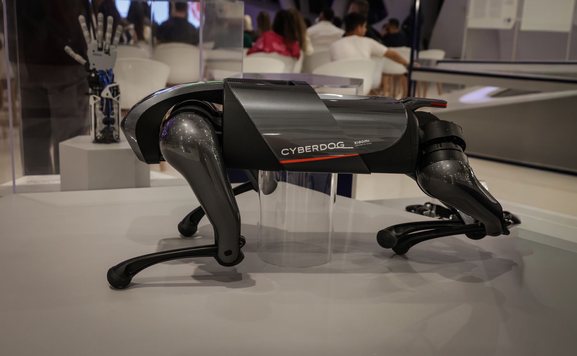

Quadruped robots are improving their ability to navigate rough, uneven terrain through advances in artificial intelligence models that process sensor data in real-time and adjust movement dynamically. Rather than relying on pre-programmed gaits or simple reactive rules, these AI systems learn patterns from simulation and real-world experience, allowing robots to adapt their leg placement, stride length, and body posture as surface conditions change. A robot encountering rocky ground, mud, sand, or steep slopes can now adjust its approach in milliseconds, drawing on learned representations of how different terrains deform under load and how stability can be maintained across varied conditions.
The core challenge these models address is that rough terrain presents infinite variation. Traditional control systems work well on flat, predictable surfaces, but a ravine filled with loose rocks, a hillside covered in fallen branches, or soil that shifts under a robot’s weight requires something more sophisticated. New AI approaches combine computer vision from onboard cameras with proprioceptive feedback (the robot’s internal sense of its own body position and forces), allowing models to recognize terrain types and predict how the robot’s body will respond before committing to a movement. This capability matters for applications from search and rescue to industrial inspection, where a robot’s inability to cross difficult ground means mission failure.
Table of Contents
- How Machine Learning Models Teach Robots Terrain Adaptation
- The Role of Terrain Perception and Its Limitations
- Real-World Applications Where Terrain Adaptation Matters
- Training Data Requirements and the Sim-to-Real Problem
- Stability Margins and Failure Modes in Difficult Terrain
- Integration With Existing Robot Hardware and Sensor Suites
- Current Limitations in Generalization and Practical Deployment
How Machine Learning Models Teach Robots Terrain Adaptation
Machine learning models for quadruped terrain navigation typically operate by learning mappings between sensor inputs (camera imagery, IMU data, foot contact forces, ground penetration resistance) and successful motor outputs. During training in simulation or controlled environments, the model observes thousands or millions of attempts, learning which combinations of leg angles and timings keep the robot stable and moving forward across different surface types. When deployed on a physical robot, this learned representation allows the system to recognize novel terrain and apply similar strategies, even if it has never encountered that exact configuration before.
The training process itself is resource-intensive. robots must either spend extensive time in the real world collecting failure data—which damages expensive hardware and is slow—or spend time in simulation, which risks learning behaviors that don’t transfer to physical reality. Many current approaches use a hybrid strategy: train primarily in realistic simulation with randomized terrain generation, then fine-tune on real hardware using limited runs. This still requires careful engineering because overfitting to simulation characteristics is a persistent problem. A model trained only on simulated sand might fail completely when it encounters real sand with different grain size distribution or moisture content.
The Role of Terrain Perception and Its Limitations
Vision-based terrain classification is part of most modern systems, allowing the robot to recognize terrain type (grass, gravel, mud, rock) before stepping on it and adjusting its strategy preemptively. Onboard cameras combined with depth sensors create a local map of upcoming surface, which the AI model uses to predict stability margins and adjust gait parameters. However, this approach has real limitations. Cameras fail in poor lighting, heavy rain, or dust—exactly the conditions where rough terrain navigation is most critical. A robot might recognize terrain visually but fail to account for subsurface properties like hidden water beneath grass or a thin crust overlying soft ground, both of which dramatically affect foot penetration and stability.
The temporal aspect also matters. A terrain classification happens at one moment, but conditions can change rapidly as the robot moves through an area. A stable-looking patch of ground might collapse as the robot’s weight presses into it, or frost-heave from overnight freeze-thaw cycles might have rendered yesterday’s passable terrain impassable today. Models trained on static snapshots often struggle with these dynamic surface changes. Additionally, the field of view from a low-mounted camera is limited—the robot can only see terrain directly ahead and to the sides, not the full area where its feet will land three or four steps forward, limiting predictive accuracy in rapidly changing environments.
Real-World Applications Where Terrain Adaptation Matters
Inspection and rescue operations are the primary drivers behind this research. A robot deployed to search rubble after a building collapse or to inspect failed slopes in remote mining areas faces inherently unpredictable terrain. A rigid controller tuned for one terrain type will fail when the robot encounters the next obstacle. Systems using learned adaptation can step from concrete to tilted metal to loose stone without stopping, pause, or human intervention. Similarly, agricultural robots that must traverse fields with varying soil conditions and crop residue benefit from models that continuously adjust their gait rather than using a one-size-fits-all approach.
However, deployment remains challenging. Most operational robots today still operate on relatively known terrain or require human oversight. A robot successfully navigating rough ground in testing labs often fails in the field when encountering edge cases the training data didn’t represent. A research lab’s carefully randomized simulation might not include the specific combination of clay soil, root networks, and slope that the deployed robot encounters. This gap between experimental success and real-world reliability is one of the largest unresolved challenges in the field. The robots work best when human operators can provide feedback or intervention, but the goal is autonomous operation in environments where human presence is impossible or unsafe.
Training Data Requirements and the Sim-to-Real Problem
Building effective AI models for terrain navigation requires massive amounts of training data, and the source of that data shapes what the model can learn. Simulation-based training is fast and safe but introduces systematic biases. Physics simulators approximate contact mechanics, material properties, and deformation, and these approximations compound. A model trained in a simulator where sand behaves slightly differently from real sand will discover strategies that work in simulation but fail when transferred to reality. Researchers partially solve this through domain randomization—introducing variations in simulation parameters—but this works only if the true environment stays within the randomized space.
Real-world training data collection is slow and expensive. Each time a robot pushes its stability limits, there is a risk of hardware damage or data loss if the robot falls into an uncrossable ravine. Commercial deployments often accept this cost by design, instrumenting robots to collect naturalistic data during regular operations and feeding successful trajectories back into model retraining. But this creates a catch-22: models must be good enough to keep the robot safe during data collection, but they improve only by collecting data during slightly risky deployments. Additionally, real-world data is inherently biased toward whatever terrain a particular robot operator chose to deploy in, potentially missing important edge cases.
Stability Margins and Failure Modes in Difficult Terrain
One persistent challenge is that AI models optimize for forward progress but can be brittle at the boundaries of stable versus unstable locomotion. A model might learn to maintain balance across wide variation in terrain, yet fail catastrophically when stability margin is exceeded—for instance, when a slope is just slightly steeper than any the model encountered during training. Unlike human climbers or experienced animals, learned models sometimes lack graceful degradation. They work well across a range of conditions but fail suddenly and completely outside that range, rather than gradually becoming more cautious.
Overconfidence is a real problem. A model trained on varied simulation data might incorrectly generalize, attempting maneuvers on real terrain that are riskier than the simulation suggested. The robot might attempt to climb a slope the model predicts is feasible but that actually is on the edge of rollover. Because models are trained to maximize progress, not minimize risk, they will take the most efficient path available even if that path offers minimal safety margin. This is why most deployed systems include conservative hard limits (for instance, maximum slope angle that is never exceeded regardless of model prediction) enforced at a lower control level, accepting reduced capability in exchange for guaranteed safety.
Integration With Existing Robot Hardware and Sensor Suites
Most AI-based terrain navigation systems are deployed on robots that have substantial onboard computing—typically a powerful embedded processor like NVIDIA Jetson or equivalent—because the inference demands of real-time perception and control models are significant. This creates a constraint for smaller or more power-limited robots, which cannot run the same models and must use simpler learned policies or fall back to hand-crafted control. For expensive research platforms, the computing cost is acceptable. For robotics applications where weight, power consumption, or cost are critical, the requirement for substantial compute is a major barrier to adoption.
Sensor fusion—combining data from multiple sensors—is central to effective terrain navigation. Cameras provide long-range perception, tactile sensors and accelerometers provide contact feedback, and wheels or footsensors measure ground engagement. Models trained on multi-modal sensor fusion are more robust than those using a single sensor type. However, sensor diversity also increases system complexity and cost. A robot with only cameras is cheaper and simpler than one with integrated force-sensing feet, stereo vision, and inertial measurement, but it will be less capable at recognizing subtle terrain properties like soil firmness or footing stability.
Current Limitations in Generalization and Practical Deployment
The most significant unresolved limitation is that learned models remain largely tied to the specific robots and environments they were trained on. A model trained for a quadruped with a particular leg length, mass distribution, and maximum joint torques may not transfer effectively to a different robot with slightly different proportions. This lack of generalization means that developing terrain navigation for each new robot design requires substantial new training data collection and model tuning. For roboticists, this is frustrating—the underlying principles are similar, yet the models don’t capture those principles in a portable way.
Real-world deployment also reveals that models trained for terrain navigation often ignore other practical constraints. A path that the model predicts will successfully cross rough ground might be energetically expensive, draining the robot’s battery in half the time expected. Or the path might be physically viable but require movement patterns that stress certain joints more than others, accelerating wear. Most laboratory research focuses on feasibility—can the robot cross this terrain—but operational robots must also consider efficiency, durability, and graceful degradation when battery is depleted. These secondary objectives are often missing from the training signal, meaning deployed systems must still rely on hand-tuned safety constraints and operational guidelines rather than purely learned behaviors.