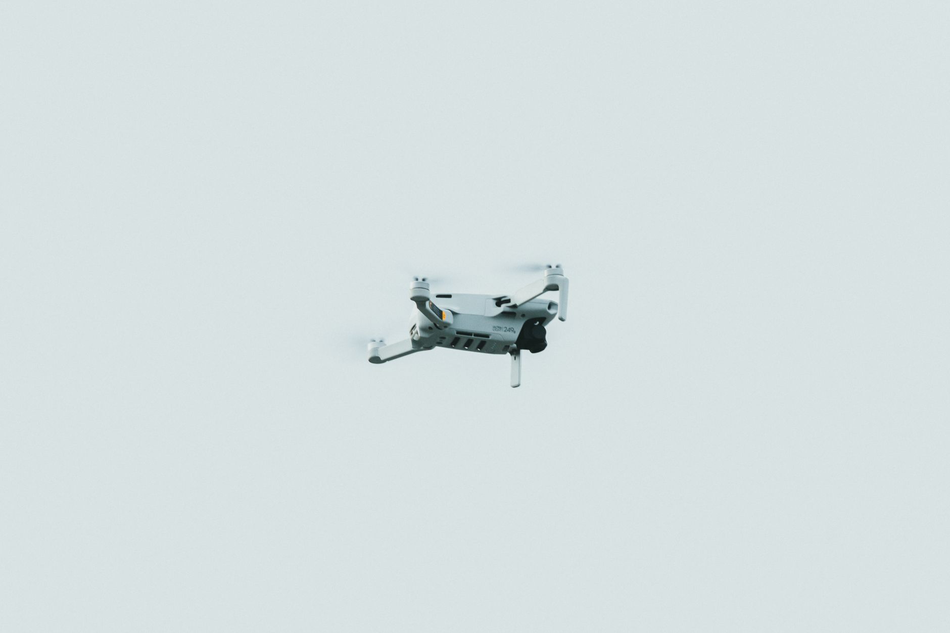

Drone detection technology combines radar and vision systems to identify, track, and classify unmanned aircraft with a precision and reliability that neither system could achieve independently. Radar provides long-range detection and all-weather capability, while vision systems—using cameras, infrared sensors, and other optical technologies—deliver high-resolution identification and precise location data.
When integrated properly, these complementary technologies create a detection architecture that catches drones at greater distances, maintains tracking through adverse weather, and enables accurate threat assessment in real time. A practical example of this integration appears in airport security operations, where a single detection platform might use radar arrays to scan approaching airspace, then hand off confirmed drone targets to optical tracking systems for visual confirmation and classification. Without integration, airport operators would need separate teams managing radar data and camera feeds independently, with inevitable gaps in coverage and delayed response times.
Table of Contents
- How Do Radar and Vision Systems Complement Each Other in Drone Detection?
- Advanced Sensor Fusion and Data Processing Architecture
- Real-World Deployment Challenges and Environmental Factors
- Choosing Between Radar Types and Vision Sensor Configurations
- False Alarms, Sensitivity Tuning, and Operational Burden
- Integration with Air Traffic Control and Automated Response Systems
- Emerging Technologies and Future Integration Trends
- Frequently Asked Questions
How Do Radar and Vision Systems Complement Each Other in Drone Detection?
Radar systems excel at detecting movement across wide areas and in conditions where optical sensors fail—fog, rain, darkness, and dust. A typical radar antenna can sweep hundreds of meters or kilometers depending on power and frequency. However, radar alone provides limited information about what it has detected; a small metal-framed drone creates a similar signal pattern to a bird, a weather balloon, or even a plastic bag in strong wind. This ambiguity is where vision systems add critical value. Vision systems—including visible-light cameras, thermal imaging, and hyperspectral sensors—can identify objects with far greater specificity once they are pointed in the right direction.
A thermal camera can distinguish a drone’s warm motors from ambient temperature, while a high-resolution camera can capture physical features that confirm the presence of a payload or weapons system. The integration works as a triage: radar acts as the early warning system, and vision systems validate and classify what the radar has found. The constraint is positioning and latency. Vision sensors have a narrow field of view compared to radar’s broad sweep. If radar detects a target but vision is not already aimed at that area, there is a delay while the optical system rotates, focuses, and captures identifying images. This delay can be acceptable in airport security but problematic in tactical military settings where reaction time is measured in seconds.
Advanced Sensor Fusion and Data Processing Architecture
Modern drone detection systems use sensor fusion algorithms that combine raw radar returns and video streams into a unified tracking picture. Rather than treating the sensors as separate inputs, fusion software creates a single, continuously updated model of the airspace. When radar detects a moving object, that detection is immediately correlated with any visible features in the video feed. If the two sensors confirm the same target location, confidence in the detection rises sharply. If they disagree, the system flags the discrepancy for human review or further sensor interrogation. The processing pipeline must handle significant computational load.
A single radar array can generate millions of data points per second; cameras and thermal sensors produce equally dense information streams. Filtering, correlating, and rendering this data in real time requires specialized hardware—typically GPU-accelerated processors—and carefully optimized algorithms. A system running on general-purpose servers will lag several seconds behind real events, rendering tracking useless for defense applications. A critical limitation is that sensor fusion depends on accurate calibration and alignment between systems. If a radar and camera are physically misaligned by even a few degrees, or if their time synchronization drifts, correlated tracks will diverge. In deployed systems, periodic recalibration is necessary to maintain accuracy, and this maintenance burden can be substantial for operators managing multiple sensor pairs across large facilities.
Real-World Deployment Challenges and Environmental Factors
Airports and critical infrastructure facilities have deployed integrated radar-vision detection systems with mixed results. At some sites, the systems perform reliably; at others, false alarm rates remain high enough that operators lose confidence in alerts. Environmental factors play a significant role. Persistent sun glare can blind optical sensors during morning and evening operations. Rain and fog don’t just degrade vision sensors; they also scatter radar signals, creating phantom returns that mimic small aircraft. A coastal facility operating such a system might discover that sea clutter—radar reflections off ocean waves—creates so many false returns that the vision system cannot keep pace with false alarms.
A correction is to adjust radar gain settings or use Doppler filtering to suppress stationary clutter, but this also reduces sensitivity to slow-moving or hovering drones. There is always a tradeoff between sensitivity and false alarm rate. Urban environments introduce different complications. Dense buildings create radar shadows and multipath reflections where signals bounce off structures before reaching the target. Vision systems face occlusion from buildings, trees, and other obstacles. An integrated system operating over a city will have blind spots that no amount of sensor fusion can remedy. Operators of such systems need to understand the physical limitations of their deployment location and plan accordingly.
Choosing Between Radar Types and Vision Sensor Configurations
Organizations selecting a detection system face choices about radar technology: millimeter-wave radar offers high resolution and compact antennas but shorter range; X-band and S-band radar offer longer range but lower resolution. Vision systems present similar tradeoffs. Visible-light cameras excel in daylight but perform poorly at night; thermal cameras work continuously but produce lower spatial resolution than visible cameras. Hyperspectral sensors can identify specific materials or engines but are expensive and require significant data processing. A critical comparison: a low-cost entry-level system might pair an affordable millimeter-wave radar with a single visible-light camera, suitable for perimeter monitoring at a small facility.
A high-security installation protecting a sensitive asset might use multiple radar arrays of different frequencies, thermal imaging, hyperspectral sensors, and backup optical systems, with redundancy to ensure no single failure point disables detection. The cost difference is substantial—from tens of thousands of dollars to millions. The tradeoff is not purely financial. A complex system with more sensors provides better detection but is harder to maintain and requires more skilled operators. Simpler systems are more robust to failure but may miss sophisticated threats or create false alarms under challenging environmental conditions.
False Alarms, Sensitivity Tuning, and Operational Burden
False alarm rates are a persistent problem in drone detection systems, especially integrated ones. A radar may detect a bird, and while human operators immediately recognize it as not a drone, automated vision systems or less-trained staff might initiate alarms or scrambles. The cost of false alarms is significant: unnecessary security responses consume resources, fatigue operators, and erode trust in the system. Over time, operators may begin ignoring low-confidence alerts, a phenomenon called “alarm fatigue” that reduces overall security effectiveness. Tuning an integrated system to minimize false alarms while maintaining detection of genuine threats is a delicate process. Increasing radar sensitivity catches more targets but also catches more birds and weather phenomena.
Reducing sensitivity decreases false alarms but risks missing small or distant drones. This sensitivity-specificity balance cannot be solved with a single universal setting; it depends on the operational context, threat assessment, and acceptable response cost. A military installation tolerates more false alarms than a civilian airport because the consequences of missing a real threat are higher. A serious warning: operators who rely on automation without maintaining human oversight can develop a false sense of security. An integrated system with low false alarm rates is not the same as a system that catches all real threats. Sophisticated adversaries may probe detection capabilities, learn response patterns, and develop tactics to exploit gaps. Human judgment and continuous threat assessment remain necessary complements to technology.
Integration with Air Traffic Control and Automated Response Systems
Some detection systems connect directly to automated response infrastructure—air traffic control networks, communication systems that alert pilots, or physical countermeasures that attempt to disable or capture detected drones. This integration adds capability but also introduces risk. An erroneous detection routed to air traffic control could trigger unnecessary rerouting of manned aircraft, creating safety hazards rather than preventing them.
The most responsible integration includes human-in-the-loop design, where system alerts prompt human review before any automated response. An operator verifies a detection on the radar and vision displays, judges whether it represents a genuine threat, and then authorizes any response. This process slows reaction time but significantly reduces the probability of responding to false alarms with expensive or dangerous countermeasures. Systems designed for fully autonomous response without human confirmation have limited operational adoption outside of military contexts where the stakes and decision speed justify the risk.
Emerging Technologies and Future Integration Trends
Artificial intelligence and machine learning are increasingly used in drone detection systems to improve classification and reduce false alarms. AI models trained on thousands of radar and optical signatures can recognize patterns that humans or simpler algorithms miss. A trained neural network might recognize the distinctive radar and thermal signature of a particular drone model, enabling identification even before optical features become visible. However, AI-based systems introduce their own vulnerabilities and limitations—they can be fooled by adversarial inputs, and their decision-making can be opaque to operators who need to understand why an alert was generated.
Integration of additional sensor types continues to evolve. Acoustic sensors that detect the characteristic sound signatures of drone propellers can complement radar and vision, particularly effective at short range. Radio frequency sensing can detect the control signals transmitted to drones, identifying operated vehicles that might be missed by purely passive detection. Each added sensor layer increases system capability but also complexity, power consumption, and maintenance burden. Organizations deploying advanced integrated systems must have the technical expertise and resources to operate them effectively or risk systems that fail silently or generate untrustworthy data.
- —
Frequently Asked Questions
Can radar-vision integrated systems detect all drones?
No. Small drones with minimal radar cross-section, drones operating at very close range, and drones obscured by terrain or buildings may evade detection. No system provides complete coverage.
What is the typical detection range for integrated radar-vision systems?
Range varies widely depending on radar power and frequency, target size, and environmental conditions. Small consumer drones may be detected at 2-4 kilometers by capable systems; military-grade systems can reach longer distances with appropriate radar technology.
How much does an integrated drone detection system cost?
Entry-level systems may cost $50,000 to $200,000 for a single deployment. Large-scale multi-sensor installations protecting critical infrastructure can exceed several million dollars.
Can rain or fog disable drone detection systems?
Fog and rain reduce optical sensor performance and scatter radar signals, but integrated systems typically remain functional with degraded sensitivity. Heavy weather can create blind spots but rarely eliminates detection entirely.
How often do false alarms occur?
False alarm rates depend heavily on environmental conditions and tuning. Well-tuned systems at controlled locations may achieve rates below one false alarm per day; complex urban environments may experience multiple false alarms per hour without careful configuration.